The Missions


Air Reconnaissance in Korea


"Alone, Unarmed and Unafraid"


Air Reconnaissance in Korea

by Glenn B. Infield

Sunday June 25, 1950, was a hot, humid day both in the United States and in Korea but the weather was no problem to Lieutenant General George E. Stratemeyer, commanding officer of the Far East Air Forces. He was on an Air Force transport plane returning to Tokyo by way of Hawaii and Okinawa after a series of conferences in Washington, D.C. Major General Earle E. Partridge, the acting commander of the FEAF while General Stratemeyer was away, was spending the weekend in Nagoya with his family. There was nothing to suggest that before this Sunday ended it would be a tragic reminder of that Sunday nine years earlier when the Japanese planes attacked Pearl Harbor.

At 0400 hours on the morning of the 25th the North Koreans launched a sudden and all-out attack across the 38th parallel in an open attempt to grab all of South Korea. It was the most flagrant Communist aggression since the end of World War II and within thirty-six hours the United Nations called upon its members to assist South Korea in repelling the invaders. The first forces ordered into action by President Truman were the air forces, including the aerial reconnaissance units available.

Air evacuation of American national took first priority, but the reconnaissance mission of the FEAF planes was of equal importance during the early hours of the conflict since the exact purpose and intentions of the North Koreans were not clear at the beginning. Many military experts, well aware of former Communist terror tactics, were reluctant to call the move all-out aggression until they were certain. The North Koreans had sent raiding parties across the 38th parallel before, but they had always withdrawn them within a few hours. However, once the reconnaissance pilots of the FEAF reported at 0900 hours on the 25th that the South Korean town of Kaesong had fallen it became obvious that the North Koreans were launching a full-scale invasion.

In 1945 it would have been difficult to find one Army, Navy, or Marine officer in the U.S. military establishment who would not have acknowledged the vital importance of aerial reconnaissance. It had been a long, difficult, uphill battle by the proponents of aerial reconnaissance but it appeared there were finally victorious by the end of World War II; that never again would the united States be caught without skilled manpower and modern equipment necessary to fulfill the aerial reconnaissance mission efficiently. It appeared that way but it wasn?t. The severe "economy" programs between 1945 and 1950 took their toll of the established aerial reconnaissance systems and prevented the required research and development programs necessary if aircraft, cameras, and technicians were to keep up with the fast-moving jet age. The FEAF had no established reconnaissance organization when the Korean War began. All it had was a scattered, undermanned, and under equipped group of units that had little or no communication among them. On Okinawa, stationed at Kadena Air Base, were RB-29s (formerly the F-13 designation) of the 31st Strategic Reconnaissance Squadron, while two RB-17s were based at Clark Air Base in the Philippines. The first jet reconnaissance planes were used by the USAF, the RF-80s of the 8th Tactical Reconnaissance Squadron, were parked on the filed at Yokota, Japan. The ground activities for these widely scattered units were handled by the 548th Reconnaissance Technical Squadron, also based at Yokota. This was the extent of the aerial reconnaissance forces available to General Stratemeyer when South Korea was invaded.

It soon became apparent that the United Nations forces fighting in Korea were going to need aerial reconnaissance even more than did ground units during World War II. This was a new kind of war, a "limited" war where political considerations were as important as military considerations and every move had to be weighed in terms of its diplomatic consequences. Many targets that appeared important to the military were put off limits for political reasons, such as the Manchurian airfields across the Yalu River. Photographic reconnaissance was the only method the United Nations forces had to keep these fields under surveillance. Using oblique cameras, the reconnaissance planes brought back pictures that revealed a great deal of information about the North Korean Air Force, such as the length of runway required for Migs, number of planes based at the field ready to fly south to attack U.N. aircraft and installations, and any new equipment that was moved into the off limits area.

Aerial photographs were also needed to provide basic information about North Korea itself. At the time of the Communist invasion the Far East Command had no combat mission toward Korea and, in view of this, it had no contingent plan for such operations. Target dossiers were nonexistent. In fact, during the first few days a young USAF officer, Lieutenant Colonel John McGinn, in order to get target information for the planes based at Suwon, a small airfield twenty miles south of Seoul, drove six miles to a ground command post. At the command post he studied the situation map on the wall, selected likely-looking targets, and wrote the target descriptions himself, which he then relayed to the pilots.

To alleviate this shortage of target photographs the 8th Tactical Reconnaissance Squadron sent a detachment to Itazuke, a southern Japanese airfield, within a few hours after Communist troops crossed the 38th parallel. Later the entire squadron moved to this base and attempted to supply the aerial reconnaissance requirements of both the Fifth Air Force and the Eight Army. It was a clumsy, ineffective arrangement. Once the pilots of the 8th obtained the negatives of the objective, the negatives had to be ferried north to Yokota, where the technicians of the 548th Reconnaissance Technical Squadron developed the prints and did the interpretation. This procedure was slow even in good weather but when weather was bad the photographs sometimes didn't reach their destination for a week.

Washington made an effort to strengthen the aerial reconnaissance forces in August and September when it was discovered that the requirements of the Fifth Air force and the Eighth Army were not being met. The 162nd Tactical reconnaissance Squadron, specialist in night photography, and the 363rd Reconnaissance Technical Squadron arrived at Itazuke to aid the 8th Tactical Reconnaissance Squadron and eliminate ferrying the film to Yokota for processing, thus making the prints available much faster. The Fifth Air Force, in an attempt to organize its scattered reconnaissance units more efficiently, established the 543rd Tactical Support Group with headquarters at Itazuke. In October 1950 the group set up a unit at K-2, Taegu, Korea. The 543rd Tactical Support Group was not a success. Supply, especially personal equipment, was in a state of chaos, morale was low, and the lines of communication among its own units and outside organizations were confused and slow. The 363rd Reconnaissance Technical Squadron, which had been designated to help process film, was set up in a school compound in Taegu City and often several hours elapsed before film arrived from the airfield at K-2. A large percentage of the flash bombs used by the 162d Tactical Reconnaissance Squadron, the night photography specialists, were duds and the film was ruined. Cooperation from the headquarters staff of the Eighth Army was very poor.


Aerial Photography


TYPES OF AERIAL PHOTOGRAPHY

An Extract from AF Manual 55-6, Aerial Photographic Reconnaissance
October 1955

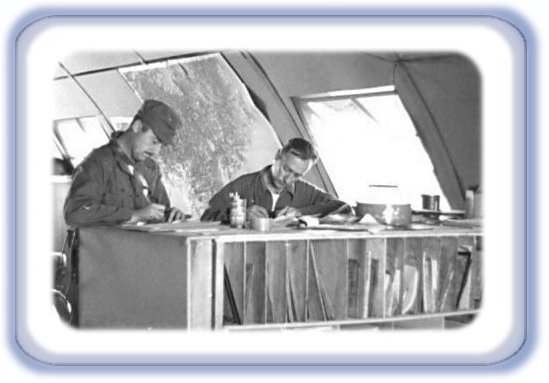
Aerial photography may be divided into six categories: vertical, oblique, fan, continuous strip, panoramic, and aerial cinematography.

Vertical Photography

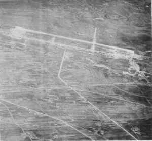
A vertical photograph is an aerial photograph taken with the camera axis vertical, or as nearly vertical as practicable, in an aircraft. The camera axis, therefore, is perpendicular to the earth and ground features appear in perspective and with minimum distortion of their horizontal dimensions.

Vertical photographs have relatively small errors of scale and azimuth which result from tilt, variation in relief features, and optical distortion. Measurements can be accomplished easily and with moderate accuracy. Scale is fairly constant throughout the photo. Verticals provide excellent aids to crews accomplishing high altitude missions.

A disadvantage of vertical photography is that it presents an image which is seen from an unfamiliar point of view. Also, only a limited field of view is shown.
Vertical reconnaissance photography is generally divided into three categories: spot photography, reconnaissance strip, and mosaic photography.
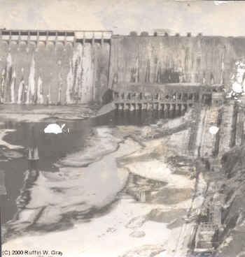

SPOT PHOTOGRAPHY

Spot photography consists of a single photo or stereoscopic pair of a particular installation; e.g., a photo of an airfield, the objective centered or pinpointed on the photo.


RECONNAISSANCE STRIP

A reconnaissance strip is a single flight line of overlapping photos taken at a constant altitude between two points; e. g., a strip of photos along a rail line.


MOSAIC PHOTOGRAPHY

Mosaics are two or more reconnaissance strips, usually parallel, with side lap between strips; e.g., parallel photo strips over a large city or battle area.
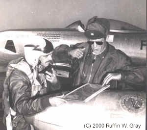
Oblique Photography

An oblique photo is an aerial photograph taken with the camera axis directed intentionally between the horizontal and the vertical. Therefore, the aircraft does not have to fly directly over the area to be photographed. A high oblique shows the horizon; a low oblique does not. A high oblique photo shows much more area than a vertical photo taken with the same focal length and from the same altitude; however, the images grow smaller toward the horizon. Objects in the background tend to lose their proper perspective, proportionate to the obliquity of camera angle, to the extent that the correct horizontal plane of individual objects cannot be determined.

In oblique photos, the terrain appears as a conventional image rather than the map like presentation of the vertical. Since oblique photos are more pictorial and more readily read, they provide excellent briefing aids for crews accomplishing low level missions.

One disadvantage of oblique photography is that scale diminishes from foreground to horizon. Calculations are also difficult and must be accomplished by means of trigonometric computation. Observation is limited to line of sight. In addition, oblique photography is not very effective at night.
Oblique photography is generally divided into three categories: spot photography, reconnaissance strip, and dicing photography.

SPOT PHOTOGRAPHY
Spot photography consists of a single photo or stereoscopic pair of a particular installation, c. g., a photo of an airfield, the objective centered or pinpointed on the photo.

RECONNAISSANCE STRIP
A reconnaissance strip is a single flight line of overlapping photos taken at constant altitude between two points; e. g., an oblique strip along a coast line, showing beach and coverage inland.

DICING PHOTOGRAPHY

Dicing photography consists of oblique photos taken from an oblique camera position at extremely low altitude and high speed; e. g., dicing run of a highway to determine the number of troops, type of vehicles, and armament of an enemy army.

Fan Photography
Fan photography is obtained from combinations of vertical and oblique camera installations. Fan photography is used for strip and mosaic coverage because of its wide lateral coverage along a single flight line. Its disadvantage is that the scale diminishes from the center to the edge.

Continuous Strip Photography

The purpose of the strip camera is to permit taking a continuous aerial picture of the terrain while the aircraft is flying at low altitudes and at high groundspeeds. By the proper selection of components, either single or stereoscopic photographs may be obtained from a single camera for reconnaissance purposes.
The camera provides stereoscopic pictures by producing two adjacent strip exposures. The images, when viewed through a stereoscopic viewer, are three-dimensional in nature. During World War II, the Navy put the strip camera to considerable use in the determination of water depths and heights of obstacles at landing beaches. At present, strip photography is employed at low altitudes.

The strip camera employs the moving film principle (film synchronized with image movement) to obtain continuous aerial strip photography. The movement of the film across the focal plane behind a variable-width slit is synchronized with the speed of the aircraft over the ground. Photography at maximum speed is thereby made possible.

Panoramic Photography

Panoramic photography is photography obtained by swinging or "panning" an aerial camera to photograph the terrain from horizon to horizon. Actually the camera is not swung. A dove prism is rotated in front of the camera lens and the result is as though the camera were swung.

Aerial Cinematography

Because the Air Force started using jet aircraft, a complete change in the techniques of taking aerial motion pictures had to be made.

When photographing from a jet, it is necessary to shoot through the Plexiglas which has very little if any flat surface; therefore, the camera lens must be placed as close to the glass as possible. The Plexiglas should be blackened out in all areas surrounding the camera and in the immediate area of the camera. This must be done to minimize the reflections. It may be done either by taping a dark cloth or brown paper inside the canopy or by painting the surface with flat black poster paint. Poster paint may be easily removed with water at the completion of the mission.

Another method of minimizing reflections from Plexiglas is to construct a cone of black cloth with an elastic in the small end that will fit around the lens housing and viewfinder, with the wide end taped to the Plexiglas. Care should be taken that the wide end of the cone allows sufficient width to accommodate any necessary camera panning and tilting. The rims of the lenses should also be blackened to prevent their reflection in the Plexiglas.

When photographing air to air combat runs on which napalm bombs are being dropped, rockets are being fired, or strafing is taking place, perfect timing is essential. The photographer and pilot must work as a perfect team at all times, and the photographer must be in constant radio contact with the pilot of both the camera aircraft and the aircraft being photographed.

AIR TO GROUND

Air to ground missions normally necessitate using a camera with large film capacity to cover the longer scenes fully. Because of the unusual degree of tilt needed and the larger type camera used, an aircraft with more room for movement is desirable. Normally this type of photography is performed from a cargo door, waist hatch, bomb bay, or if direct verticals are necessary, a camera hatch on the floor of the aircraft. A camera with a variable type shutter is recommended. The shutter degree opening should be 90 degrees or less when photographing straight down at lower altitudes; if this is not done, a picket fence type effect results. Photographing bomb drops and bomb evaluation missions are classified in this air to ground category.

GROUND TO AIR

Ground to air cinematography entails many varied assignments for the motion picture cameraman. A few are: air-to-ground support, test of new type aircraft, guided missiles, fire power demonstrations, and data recording. The cameraman must be in constant practice to be proficient in tracking airborne missiles. Camera speed and shutter speed vary, depending on the type of coverage desired. A tripod and the down chain should be used because longer focal length lenses are usually needed which demand a very sturdy mount. To date, no known professional type tripod is capable of direct overhead tracking without some type of modification such as a 90-degree angle placed between the friction head and the camera body. Filters should be used in this type of mission due to the atmospheric haze frequently encountered. The choice of filter depends entirely upon the location of the work and the desired results.

Aerial cinematography may be used to great advantage by the Air Force in all categories listed above, whether it be in data recording for research or on an air strike. Through motion pictures, the mission of the Air Force is best told to its own personnel and to the general public.

Photographic, visual, weather, and electronic reconnaissance are all important in securing information necessary to wage successful warfare. In this manual, however, we will be concerned only with aerial photographic reconnaissance.

We have discussed the types of aerial photographic reconnaissance and seen how the cycle from pioneer through strike to surveillance provides a comprehensive survey of the enemy, his targets, and terrain. Cartographic reconnaissance provides photography necessary for preparing maps for ground operations and navigational and target charts.

These aerial photographic reconnaissance missions are accomplished by various types of aerial photography: vertical, oblique, fan, continuous strip, and cinematography.

In this chapter, we have seen the over-all picture of aerial reconnaissance and more specifically, aerial photographic reconnaissance.

The material in the next chapter goes into the principles with which you must be familiar in performing aerial photographic reconnaissance.


Mission Briefings


Major Ruffin W. Gray and Lt. Rocky Emerson


MISSION BRIEFINGS

by Norman E. Duquette, Lt. Col., USAF (Ret)

There were two types of briefings which we received. One was a mandatory daily, early morning briefing for all Pilots of the Recce Group at the large Group Ops briefing building. This briefing covered the generalities of the theatre, weather forecasts, intel reports on flak locations, combat losses by service aircraft Navy, Marine, Air Force (where lost and suspected cause, parachutes seen, survivor info etc), ground forces activities/losses, etc.

The second type of briefing was Photo Mission specific and was given by our Squadron intel folks in our own Squadron Ops Nissin Hut. Our targets and/or area of desired photo coverage would be annotated on a map and the map given to us. Specific items of intel interest, areas to be covered by photos, i.e. mission purpose would be covered by our air intel guy or GLO (ground liaison officer), visual recon requirements, which cameras were to be used, i.e. vertical / oblique / nose etc., desired photo scale/altitude to be flown, operational reminders of flak locations/MiG activities and other friendly air operations underway en route to or in the target areas.

At this point, we would turn over our personal pocket junk to the intel guy for safe keeping and in turn, we would be issued an intel/Survival packet of blood chits (if shot down, promises of payment to anyone rescuing us and turning us over to friendly forces), gold coins for barter if needed, survival maps/silk, etc.

We would then transpose the target information onto our own individual maps which each individual had made up for his own personal flight navigation throughout all of North Korea, to and from target area. This consisted of a glued together series of integrated maps covering all of North Korea and the whole thing was covered with a transparent, stick on surface which could be wiped clean after each mission and made ready for the next batch of targets.

Debriefing was done by Squadron intel and we would relate mission accomplishments, photo recce coverage, direction and altitude of flight of photo coverage, visual recon sightings etc. At debrief we would again make the exchange of survival goodies for return of our own personal junk. All quite simple and straight forward.


U.S. Air Force Blood Chit


"A Blood Chit was a promise, printed document, piece of paper, by the US Government to redeem a downed airman for gold/money. It was another "long shot" possibility for saving the life of a captured Airman. The "document" was referred to as a "blood chit". I do believe that they were registered items and it was an intelligence function to keep track of those issued items. The packet of "goodies" including some gold coinage, the silk map, the "blood chit", etc. were issued by the intelligence guys in exchange for ones personal items, such as wallet, etc before launching out onto a mission. Upon return from the mission, the exchange was again made, this time in reverse." -- Norman E. Duquette

"My recollection of the accounting for the "goodies" packet jibes with the comments made by Bill and your father. During my time in Korea the packet, which also included a rectal compass, was issued prior to flight and returned after flight. The silk maps and the blood chit I "stored" in my flight suit. Many of us retained "our" blood chit and maps as souvenirs. On my departure from the 15th there was a shortage of the silk maps covering Korea and I was ask to turn mine in. As a result the only maps I retained cover southern Manchuria and the very northwest corner of Korea. I do have "my" blood chit, number 4082, lithographed by S.S. June 1949. As I recall many flight crews flying in Asia during WW II had the blood chit sewn on the back (outside) of their flight jackets for quick identification if downed behind the lines ... or downed in many of the so called "friendly" areas." -- Edwin D. Stoltz

"My blood chit is very similar to the one you displayed. Mine was dated S.S. June 1949, number 1074. The languages across the top are Chinese Korean Japanese and Manchurian. Down the left side are Mongolian Russian and French. One the lower right is Tibetan. It also is marked RESTRICTED." -- Mort Cameron

"If I remember correctly, it [the survival kit] also contained a wristwatch, sewing needles and a couple of ballpoint pens. Korean women would supposedly go ape over needles. The chits were well guarded and kept locked up when not in use and returned to intel after the mission." -- Bill Nimmo

"Blood Chits: A Brief History"

Blood chits, identification flags, and escape flags are all terms used somewhat interchangeably by veterans and collectors alike. Technically to truly be a "chit" there must be a pledge of reward for the safe conduct and return of the bearer of the chit. Generally these items were designed to provide rapid identification to a downed pilot and facilitate assistance from local allies these pilots may have encountered. Most featured a flag with a message printed in one or more native languages. A message found on one type of US chit in 17 languages, used in the CBI theater reads: "Dear friend, I am an Allied fighter. I did not come here to do any harm to you who are my friends. I only want to do harm to the Japanese and chase them away from this country as quickly as possible. If you will assist me, my government will sufficiently reward you when the Japanese are driven away."

Blood chits were first used by the A. V. G. operating in China. These chits had the flag of Nationalist China at the top with the message in Chinese below. Many airmen wore these on the back of their jackets, but later found it best to sew them inside in case they were downed in a Communist area.

When sewn inside on three sides with the top left open, they made handy map pockets as well. The official versions of these WWII era chits were printed on cloth, but eventually, local artisans produced many unofficial versions of hand-embroidered silk and leather.

Korean/Vietnam War era Blood chits displayed the flag of the United States and the message written out in several languages from that area of Asia. As with all the chits, serial numbers were printed on each and were to be "issued" to the pilots to help aide in the identification process should the pilot become missing or die in a crash, and the chit was later to be found. This was not always the case, as many aviation units just handed out or placed the chit in the pilot's survival kit or flight suit, never documenting the serial number. On the other hand, some units considered the chit a "sensitive item" and strictly followed unit SOP for issue of the chit, placing the serial number in the pilot's official military records.

Over the years the message printed on the chits were changed to aid in the pilot's safety without giving more information than needed about the reason for his sudden presence. Whereas in WWII, the chit may have said, "I'm an American service member, here to fight the German or Japanese forces..." In 1962, the Southeast Asia - West Central Pacific version of the chits were changed to read: " I am a citizen of the United States of America...Misfortune forces me to seek your assistance in obtaining food, shelter and protection..." Written in such a matter as to not inflict unnecessary harm to the pilot/crewmember should he be found or captured in enemy territory.

To this day, Blood Chits are issued to pilots and crews operating in hostile territory. Although sometimes controversial, they remain essential to a pilot's safety, and could perhaps someday save his life.

DEPARTMENT OF DEFENSE POLICY ON BLOOD CHITS

To provide United States Department of Defense (DoD) policy clarification and guidance relating to “Blood Chit” use and compensation.

Through the blood chit program, the United States Government promises to compensate anyone who assists an American service member or other Department of Defense personnel to survive, evade, resist, or escape in hostile territory and return to friendly control. Blood chits, as identified in Joint Publication 3-50.3 Annex E, are a tool used by an evader or escapee after all other measures of independent evasion and escape have failed and the evader(s) considers assistance vital to survival. Upon receiving assistance, the evader or escapee provides the assistor with the blood chit number. When the assistor or his representative presents the blood chit number to American authorities and the U.S. Government has validated the claim properly, and upon the service member’s return to friendly control, the blood chit represents an obligation of the U.S. Government to compensate the claimant, or his immediate family if the claimant is deceased, for services rendered to DoD personnel.

The U.S. Government policy is to compensate individuals who assist American service members and other DoD personnel in hostile areas to return to friendly control, independent of whether or not the individual was issued a blood chit. The U.S. Government may also compensate individuals who risk their life, livelihood, or freedom to assist DoD personnel, who do not survive or remain missing, when reliable sources can validate the claim. Due to the sensitivity of the issue, DoD must ensure that it communicates this policy clearly and consistently.

DoD activities shall brief their personnel on this policy and ensurethat it is followed.

http://131.84.1.34/dpmo/faq/policy-blood_chit.htm

For further reading, we recommend - Last Hope : The Blood Chit Story (Schiffer Military History), by R. E. Baldwin, Thomas Wm. McGarry, Hardcover (March 1997) Schiffer Publishing, Ltd.; ISBN: 0764302221
Commentary by Thomas Wm. McGarry, co-Author of Last Hope: "Blood Chits were NOT invented or first used by the A.V.G.
As detailed in our book LAST HOPE, the first recorded use of what came to be known as"Blood Chits" was by members of the Royal Flying Corps 31 Squadron in India in 1917.

While we have been unable to document how the A.V.G. first learned of these devices,we believe contact between the A.V.G. and the RAF in Burma in 1940/1941 may have lead to C. Chenault creating a version of the chits for use by the A.V.G."

Added July 2004, by R. E. Baldwin: "On another hand the idea may have come from the Chinese themselves. In this vein, I posess a Siamese Army pilot identification card issued in 1929 that is similar to the FAI cards issued to European and American aviators. It contains a blood chit type of request for assistance for a downed pilot in written in Thai, Urdu, Chinese, French, English and German. This may be evidence that the idea for blood chits in Asia originated with the FAI cards in Europe. It is certainly evidence that the idea for blood chits was not new in Asia when the Chinese first issued them during the winter of 1938-39 to American and European members of the 14th Volunteer Bombardment Squadron, a predecessor to the A.V.G.

Whether of European roots or an independent idea in Asia, these colorful squares of fabric have indeed saved countless lives."

Artwork: AII POW-MIAText Credit: Reprinted With Author's Permission - DoD/DPMO Credit: DPMO FAQ on Policy


A Trip to the Yalu


A Trip to the Yalu

by Norman E. Duquette, Lieutenant Colonel, USAF (Ret)

John, thanks for all of the pictures and info on George Davis. Them Airfields sure look familiar. I may have even taken those pictures because Antung and Tatungkou Airfield photos were the specific targets on a mission which I flew on a couple of occasions. Maybe they were even the targets on the mission escorted by George Davis.

I recall the specifics of the route of flight and the actual flying of the mission itself, but do not recall the escorters. Typically, there was the rendezvous over Chinnampo Peninsula, normally SOP for long range reconnaissance, the calling off of MiG trains leaving the station as reported by "Stovepipe Control" and the F-86s weaving overhead as escorts. Far ahead in the skies over China, the tiny silver dots and contrail streamers would start to form as the Migs climbed up through contrail altitude. Contrails over North Korea/China start to form at about 28,000 feet and quit forming at about 34,000 feet in the late fall and winter time. A defensive measure/bit of information well worth knowing. It makes an airplane harder to see if they ain’t pulling contrails. You either fly above or below the contrail level.

My RF-80 chuffing along on a straight course at top speed, 600 MPH, to enable the F-86s to keep their combat speed up. In effect they were making S-turns overhead and behind me, thus traveling a greater distance than I was, but at a faster rate of speed than I was traveling. The plan was for me to drop away from the escort over the next peninsula, a prominent land feature readily identifiable from high altitude, on the west coast just south of the mouth of the Yalu River, I have forgotten the name of the Peninsula, but it had the common geographical reference of "Long Dong" to all fighter Pilots. I think the actual name sounded similar to the nick name that it was given.

So, from about thirty five thousand feet, above the contrail level, I began my straight ahead decent through the contrail level over "Long Dong" as planned, to an altitude of about ten thousand feet, pointing the nose of my aircraft directly at Antung, really zinging along. My RF-80 was equipped with a forty inch focal length telescopic lens pointed straight out the front/nose camera window at an angle of about ten degrees below the horizon giving me photo coverage from about thirty degrees ahead/below the aircraft to almost the horizon straight ahead. All of that and a full roll of 360 feet of 9" X 18" film.


Tatungkou Airfield
Tatungkuo Airfield, China
(USAF reconnaissance photo)

I had been briefed to not cross the Yalu River into mainland China on my photo run. By the time I reached the south boundary of the Yalu, I was down to about five thousand feet, with camera running, clicking away. My flight plan called for me to make a straight in run to Antung and then to make a hard left turn when I reached the north side of the river, fly parallel to the river for about a minute, then do a hard turn to the right, and to point the aircraft directly at Tatungkou for a straight in run, which I did.

I continued in my decent to about 2500 feet and to a distance of about a couple of miles from target, then another hard left turn and a decent to water level and on out to Sea, where I picked up a southerly heading as fast as my RF-80 could scoot. The F-86s were engaged with Migs all the while I was in my photo run and escape route. I had apparently gone undetected by the Migs. At least, I did not see any in close proximity, and believe me, I was looking with head on a complete 360 degree swivel.

Again, as I approached Chinnampo Peninsula from the North flying at sea level, I proceeded back to an economic fuel consumption altitude for my return flight to Kimpo. The pictures came out GREAT. With a forty inch lens, it brings a target up really close. I wish that I could get my hands onto the photo archives of the actual photography I took that day. It was beautiful stuff. Intel thought it was great. I was, however, chastised, with tongue in cheek and admonished, that "next time don’t get so close in to the target".

I would assume that an Intel archive exists somewhere. The negatives were normally annotated with photo unit number, date, target, etc. There is undoubtedly a photo interpreters analysis of the pictures somewhere with my name on it. That was a great feeling, to fly up there, right into the enemies backyard, and undetected get pictures of their airfields complete with a bunch of Migs still sitting on the ground. YA-HOO! And, get back home to Kimpo, unscathed for another game of "Bottles" or Indian "Call Signs".

Copyright (C) 2000 Norman E. Duquette


Dicing Missions


Norm Duquette: I must have slipped up in some of my explanations of the various camera angles, camera locations, camera coverage areas, and some of the terminologies used. The term "dicing" refers to the nose forward oblique camera which is mounted in the nose of the airplane and is pointed straight forward and down about ten degrees below the horizon. A very long focal length lens, 40 inch, is normally used to bring the target in very close. This is the camera which I talked about using on the photo runs to photograph Antung and Tao Tung Kao up on the Chinese side of the Yalu. The technique is referred to as dicing and the camera is called a dicing camera. The technique calls for a straight in approach to the target, pointing the camera, ie, the nose of the airplane, essentially at the target during the entire photo run to the target. I think that the term originated in WW2 as it was a "dicey" way to get aerial photos. The results were great in that the long focal length of the lens "brought the target in very close" for the photo interpreters, but, the mission profile was dangerous for the Photo Joe, it was "dicey", thus the terms dicing mission, dicing camera.

Ed Stoltz: Just saw your question on dicing missions. A forward oblique could be installed in the RF-80 to photograph through a small window in the nose section. These were called dicing missions. Someone else will have to explain why as I would only be guessing. This camera installation was often used for low level runs where a side oblique would have blurred at high speed on a low level run or where the aircraft could only get at the target on a head-on run. Remember we were dealing with WW II cameras that had been developed long before WW II. A major draw back to the dicing installation was the radio compass antenna had to be removed for the forward pointing camera. The radio compass was the only on board nav aid available on an RF-80.

Ruff Gray: The word "dicing" comes from WWII when recce airplanes were fitted with cameras shooting out the nose in a forward position. You had to go in low and basically with wings straight and level for the run-in. Usually the targets were in heavily defended areas and losses were high. I vaguely recall that the Brits originated the term "dicing" because the pilots would shoot dice to see who got the 'honors' of flying the mission.

In our case, we had several aircraft with a 40" focal length camera shooting out the nose. The low level picture that I sent of the Dam on the Yalu was taken on a "dicing" run. We also had a couple of birds that had a 35mm movie camera mounted to shoot straight ahead. We had a series of missions called "Vandenburg Specials" where we went in as No. 5 in a flight of 4 fighter bombers to document and record damage from strafing and rocket attacks. We didn't even process the movie film. It went into a canister and airmailed to Washington.


The Weather Run


THE WEATHER RUN

by
Lt. Col. Norman E. Duquette, USAF (Retired)

The effective use of men and materiel in an air campaign is dependent upon having a reliable weather forecast. Sending hordes of bomb-loaded airplanes into a target area without some expectation of success would be a foolhardy endeavor. The majority of the missions being flown into North Korea were fighter bomber interdiction missions seeking to cut off enemy supplies by destroying roads and railroads--the routes of supply. To be effective, these missions required a visual sighting of the target area by the fighters doing the bombing or strafing runs. Airplanes of that day were not as sophisticated as those which we now have. Except for the big bombers which were equipped with radar, all attacks were done with visual reference to the target area and the target. Thus weather recce missions were a very important aspect and precursor of any successful air mission.

Weather systems evolve and migrate in pretty much predictable patterns. In general, they move from a Northwesterly area towards a Southeasterly direction. In the case of Korea, these systems move from China and the Western Sea off Korea towards the Korea mainland and then on to Japan. Weather systems have certain clouds and cloud patterns associated with them and knowing the clouds and cloud patterns in existence and their locations is a great boost to the weatherman in predicting target area weather.

The purpose of the early morning "weather run" was to assist the weatherman in his assessment of the weather report for the day's scheduled operations. It was an augmentation to existing weather prognosticating systems and made predictions much more accurate. A unique need, in a unique war and we provided a unique service effectively and proudly.

Weather Recce was a continual, on-going aspect of each air mission--not just recce--throughout the day. It was an integral part of each mission debriefing for fighter, fighter-bomber, bomber, and recce squadrons. However, when it was suspected that ongoing or incoming weather systems might be a detriment to the day's proposed fighter and fighter-bomber missions, the before-dawn Photo Jet weather reconnaissance was THE decisive source of actual weather conditions. My estimate is that these predawn weather missions were flown three or four times per week on average depending upon the time of year, and the existing and anticipated weather systems. In other words, on an "as needed basis" or "You call, we haul -- the alone, unarmed, unafraid, will get the job done".

The Recce Pilot would make a visual observation of existing clouds and cloud cover over the entire area of North Korea, as far as the eye could see from the vantage point of the track he had been assigned to fly. He would observe and make notes on his map of the various types of cloud cover, the estimated altitude of the base and the tops of the cloud coverage he has observed, the area covered by the clouds, and contrail altitudes.

En route back to home base the Recce Pilot would give a radio report of his general weather findings to operations controllers, and a more detailed briefing to Intelligence when he returned to Squadron Operations. This information would be used by the mission planners at 5th Air Force Headquarters in scheduling the fighter and fighter-bomber operations for the day.

If the cloud cover in an area would allow fighter-bombers access to the proposed target area, then the mission was a "go". It was all fairly straightforward. However, it was a very lonely, dangerous, early morning trek for another "Ace" Recce Pilot of the Photo Jet Squadron -- the same guys who helped make the whole day's operation possible. They located the targets before the mission, did the bomb damage assessment after the mission, and determined the weather accessibility of the targets for the mission. A vital spoke in the whole operational wheel.


THE WEATHER RUN

"As I remember the weather run, it was usually a pre-dawn take-off. The route was usually north a bit above Wonsan and the over to Anju, so if it was clear you could see up to the Yalu. I remember drawing flak coming out of the base of the clouds. It showed they were waiting for us and did track us.

Usually [flown] once a day by one plane. At K-2, it was very interesting as smog (smoke and fog) drifted over the field and you lost sight of the runway on downwind and then kind of groped for the runway. These landings drew a crowd. It was 5700" of pierced steel and slippery when wet. If the weather was good the fighters took off. During the day we all [aircraft] reported back the weather. If you flew the weather mission you often were able to get in another mission." -- Mort Cameron, 8th & 15th TRS


"I remember, on some of those cold, clear, winter mornings, hearing the weather mission pilot reporting from somewhere up near Pyongyang, that it was "CAFB". "CAVU" gave way to the more "picturesque" verbiage on occasion." -- Clyde Voss, 15th TRS

"Reminds me of the Inchon sucker hole. Seems there was usually an open space off towards the water from Kimpo. As you let down through it, the Navy would start shooting. That told you where you were for sure...." -- Jack Griffiss, 15th TRS


Escorts Duty


An extract from:

Escorts to R.F.80s
(Photographic Reconnaissance)

by
Squadron Leader W. Harbison, Royal Air Force
Feb-May 1952

52. F.86 groups in Korea are frequently called upon to provide escort cover to photo—recce F.80s which work as far North as the SUIHO reservoir and SINUIJU, which is within a few miles of ANTUNG. To date the Migs have not succeeded in shooting down an escorted F.80. Depending on the target and current Mig activity, 12 to 16 F.86s are used as an escort, although 8 aircraft have occasionally been used.

53. F.86 and R.F.80 pilots are briefed together in order to achieve the closest co-ordination. Formerly it was the practice to rendezvous over some known landmark about half-way to the target. This system, however, has been abandoned due to rendezvous difficulties on poor and hazy days. The R.F.80 and F.86s line up on the runway at the same time, with the R.F.80 leading the formation off. Once airborne, the F.86s throttle well back and climb out on course, in company with the recce aircraft, in flights of four aircraft. When the formation reaches a region where an attack could be expected the F.86s increase speed; one flight of F.86s splits into pairs and each element weaves across the top of the R.F.80 at a Mach never less than .80; a second flight splits into pairs also, and these elements weave about 5,000 feet above the R.F.80 and its close escort flight; the remaining two flights stack at 5,000 feet and 10,000 feet above the second flight and sweep ahead of the R.F.80. These last mentioned two flights act as a screen between the recce aircraft and any Migs which may be around. These screening flights try to keep visual contact, with each other.

54. Escort missions are very tiring; a great deal of weaving being necessary, and it is often difficult to keep the R.F.80 in sight. When the enemy attempts to intercept and press home an attack on the R.F. 80 the latter heads for the open sea, the four close escort F.86s remaining with him until he is in safe territory. Meanwhile, the remaining flights of F.86s engage the Migs and divert them from the R.F.80. Despite the fact that the slow blip on their radar warns the Migs what to expect they rarely molest the R.F.80s. Flak has proved to be the recce aircraft’s greatest danger and at the R.F.80s photo altitude of 18,000 feet, it is fairly accurate.


100 Mission Chart


Captain Cecil Rigsby's 100 Mission Chart

MISSION PROGRESS CHART

by
Cecil H. Rigsby
Colonel, USAF (Ret)

I constructed the Mission Progress Chart so I could keep track of my combat missions in Korea. Other pilots in my tent were invited to use it. 1st Lt. Edgar H. Hill and I started our combat tour at the same time so our missions tend to overlap. 1st Lt. E. T. "Priest" Brown, our highly religious tent mate, stopped using the chart or rotated. I don’t recall. 1st Lt. Gerald E. Lyvere was transferred to the 4th Fighter Wing after 31 missions. He shot down a MiG shortly thereafter.

The chart provides a lot of information about the 15th Tactical Reconnaissance Squadron’s operation during my tour. Under our motivated Squadron Commander, Major Ruffin Gray, we probably flew more combat missions that any squadron in Korea. Our record for a single day was 55 missions, with 30 - 50 missions in the normal range when the weather cooperated. The 15TRS was the only squadron providing photo reconnaissance of North Korea for FEAF HQ, 5th Air Force and all Army units. The number of pilots in the 15TRS ranged from 35 to 40. If we count the RF-86s and the RF-80s we had nearly as many airplanes as two squadrons.

My chart indicates that I completed my 100 combat mission tour in 132 days. I only went 41 days during this period without flying a combat mission. Two missions per day was flown 18 times. Also, the rate of flying missions was the same for the pilots in my tent. I feel certain it was the same for all other combat ready pilots available for duty. It is obvious that hundreds of pilots cycled through the 15TRS during the Korean War. The length of a combat tour was 100 combat missions.


Going Home


The "100th Mission" Photo


100 Missions - Capt. Richard Stearns (left), 15th TRS

100 Missions - 1Lt. Neil Baird (left), 15th TRS

100 Missions - 1Lt. Frank Meyer (right), 15th TRS

100 Missions - (L to R) Lts. Bob Williams, Ray Powell, Tom O'Connell, 15th TRS

100 Missions - (L to R) Captains Ernest R. Harden III, Jesse O. Sandlin and James W. Nimmo, 15th TRS

100 Missions - Maj. Ruffin W. Gray (left), 15th TRS

100 Missions - Richard E. Chandler (left) and Kenneth T. Blank, 15th TRS

100 Missions - 1Lt. Irv Burrows (left) and Lt. Joe Lanahan, 15th TRS

100 Missions - 1Lt. Hal Marston, 1Lt. Neil Frazier and 1Lt. Norm Fredkin, 15th TRS


Click logo to return back to Main page.